Snow Emergency for Hamburg, NY: over 3 feet of snow with buried neighborhoods, cars, gridlock on roads.
All footage shot during afternoon daylight on November 18, 2022 in Hamburg, NY by Michael Gordon and Meteorologist Simon Brewer
Shot Description
1 & 2. massive block of snow on car driving in Hamburg NY
3-13. various shots of accidents and gridlock traffic from deep snow in Hamburg NY
14-22. various shots of buried neighborhoods, cars, and snow plows in Hamburg NY
23 -25. various shots of “Highmark Stadium: Home of the Buffalo Bills”
SID: Michael Gordon Simon Brewer
To License This Footage For Broadcast, Contact Video @ StormChasingVideo.com
#Lakeeffectsnow
#winter
#NYWX
#weather
#icyroads
Amazing drone time lapse footage of the intense lake effect snow band next to downtown Buffalo, NY coming in off the lake.
Rare waterspout next to downtown Buffalo, NY over Lake Erie from a powerful lake effect snow band slamming the area. Some people call this a “Snownado”.
All footage shot during daylight on November 18, 2022 in Buffalo, NY by Michael Gordon and Meteorologist Simon Brewer
Shot Description
1. incredible drone footage time lapse of lake effect snow band over Lake Erie and Buffalo, NY
2-4. various drone shots of intense lake effect snow band hitting Buffalo NY
5-7. various shots of waterspout next to Buffalo, NY over Lake Erie caused by intense surface-based lake effect storm
SID: Michael Gordon Simon Brewer
To License This Footage For Broadcast, Contact Video @ StormChasingVideo.com
#Lakeeffectsnow
#winter
#NYWX
#weather
#drone

Meteorologist Simon Brewer is out in the lake effect winter snow storm and live storm chasing this EPIC AND VERY MASSIVE and dangerous Winter Storm moving over Lake Erie to bring upwards of over 48-72 inches or 4-6 feet of snow to the Syracuse, NY area. The large winter storm could bring snowfall rates of up to 4-6″ of snowfall per hour leaving the area in a pure whiteout. Be prepared and stay warm.
SID: Simon Brewer
To License This Footage For Broadcast, Contact Video @ StormChasingVideo.com
#lakeeffectsnow
#winterstorm
#snow
#nywx
#buffalony
#StormChasing
#severeweather
#irl
#syracuse
Multiple accidents, treacherous driving conditions, very low visibility, deep snow, and trees falling down from heavy wet snow in Parish, NY.
Beginning stages of potentially historic lake effect snow event for Upstate New York!
All footage shot during morning daylight on November 17, 2022 in/near the Village of Parish, NY by Meteorologist Simon Brewer
Shot Description
1-11. various shots of accidents from very heavy snow with emergency response in/near Parish, NY on Interstate 81
12-14. various shots of over a foot of snow burying vehicles in Parish, NY
15. powerlines sagging from weight over very heavy wet snow in Parish, NY
16-19. trees downed from heavy wet snow in Parish, NY
20 & 21. ruler measuring 17 inches of snow accumulation in Parish, NY
22-26. various shots of Parish, NY neighborhoods buried in 17 inches of deep snow
27-29. various POV shots of snow plows clearing Interstate 81 in Parish NY
30. power lines sagging under weight of very heavy wet snow in Parish NY
31 & 32. front loader clearing snow in parking lot in Parish NY
33. Electronic highway sign warning of Heavy Lake Effect Snow on Interstate 81 with traffic and heavy snow falling in Parish NY
34. snow-covered trees in Parish NY
SID: Simon Brewer
To License This Footage For Broadcast, Contact Video @ StormChasingVideo.com
#Lakeeffectsnow
#winter
#NYWX
#weather
#icyroads

Simon Brewer is live storm chasing this Massive and very dangerous winter storm moving over Lake Erie to bring upwards of over 48 inches or 4 feet of snow to the Buffalo, NY area. The large winter storm could bring snowfall rates of up to 4-6″ of snowfall per hour leaving the area in a pure whiteout. Be prepared and stay warm.
SID: Simon Brewer
To License This Footage For Broadcast, Contact Video @ StormChasingVideo.com
#lakeeffectsnow
#winterstorm
#snow
#nywx
#buffalony
#StormChasing
#severeweather
#irl
Autumn snowfall snarls traffic in the Minneapolis Metro causing multiple crashes on area highways. Heavy snow, poor visibility, multiple spinout and wreck scenes, emergency vehicles, congested traffic in falling snow and snow covered roads. Remote traffic camera video via MN DOT network. No audio.
Shot Description
1) Minneapolis highway sign with wet roads and snow on ground.
2) Wide shot of snow covered highway interchanges in Minneapolis metro area.
3) Heavy snow and poor visibility on highway.
4) Multi-vehicle accident scene #1
5) Multi-vehicle accident scene #2
6) Multi-vehicle accident scene #3
7) Multi-vehicle accident scene #4
8) Single vehicle accident scene.
9) Snow covered bridge and traffic.
10) Accident scene close with two fire trucks just arriving with first responders.
11) Single vehicle wreck with tow truck.
12) Multi-vehicle wreck scene.
13) Multi-vehicle accident scene with driver getting out.
14) Single vehicle accident scene with first responders walking up to car.
15) Spinout scene with first responders arriving.
16) Multi-vehicle wreck scene.
17,18,19,20) Four scenes of traffic in snow and poor visibility.
21) Flat bed towing away wrecked vehicle.
22) Traffic tight show in poor visibility in snow.
23) Intersection with US flag and snow.
24) Traffic in poor visibility in snow.
25) Accident just happed and white car with damage pulling off on shoulder.
26) Zoomed shot of damaged white car with driver and dog getting out then pullback to full accident scene.
27) Tight show off traffic in poor visibility and snow with school bus going thru frame.
SID: Brian Dombrowski
#MNWX #Winter #Snow

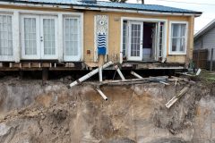
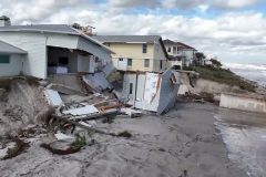
Raw footage from St. Johns County, Florida of the massive beach erosion and storm damage to the area.
Footage of destroyed structures and areas completely void of sand where large sand dunes once stood.
SID: Michael Gordon
#flwx #florida #hurricanenicole #aftermath #stjohnscounty
To License This Footage For Broadcast, Contact Video @ StormChasingVideo

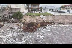
Raw footage from this morning, 11/11/2022, we did an extensive drone survey of the damage along the coast of Daytona Beach as the winds have now calmed down to the point where we are able to fly in a safer environment.
Footage shows the major coastal damage to the homes along the shore of Daytona Beach, Florida.
SID: Michael Gordon
#flwx #florida #hurricanenicole #aftermath #stormsurge #destroyedhomes
To License This Footage For Broadcast, Contact Video @ StormChasingVideo
Raw footage from this morning, 11/11/2022, we did an extensive drone survey of the damage along the coast of Daytona Beach as the winds have now calmed down to the point where we are able to fly in a safer environment.
Footage shows the major coastal damage to the homes along the shore of Daytona Beach, Florida.
SID: Michael Gordon
#flwx #florida #hurricanenicole #aftermath
Long Edit of the drone video showing the extensive and catastrophic damage along the shoreline of Daytona Beach Florida from Hurricane Nicole and the storm surge.
Buildings destroyed and foundations undermined as the waves ripped away the sand making the area unsafe for many of the structures.
Shot Description
00:00 Footage of the road block along the beach front properties.
00:11 Several clips of the catastrophic damage to hotels and condos along the beach with the sea walls destroyed and pool areas smashed.
01:34 Long clip of the major damage along the beach front to multiple structures.
02:57 Waves crashing into several destroyed areas.
03:57 Footage of undercut foundations and extensive damage to a large tall condo building.
05:33 Looking out over the waves off shore moving on shore.
05:46 Moving shot over several buildings that have damage.
06:14 Footage of the foundation exposed.
07:16 Destroyed pool decks.
08:13 Fly over shots showing extensive damage to beach front properties.
SID: Michael Gordon
#HurricaneNicole #FLWX #Florida #stormsurge #Drone
Hurricane Nicole Chase (South Florida to East-Central Treasure Coast)
Shot Description
1. Deerfield beach pier waves and surfers.
2. Fast moving clouds and rain (Deerfield Beach, FL).
3. 2 shots of flooding docks and marina in Jupiter, FL.
4. Leaves in road near Hobe Sound.
5. Radar shot and commentary, with road and leaves / debris.
6. Stuart Causeway.
7. 3 shots of picnic area off Stuart causeway.
8. 3 shots of south side of Stuart causeway and rising water.
9. Jensen Beach – 2 shots of storm surge coming down pathway and into parking lot.
10. Locals / storm chasers in strong winds on Jensen Beach.
11. 7 shots of Jensen beach causeway and flooding / surge with winds.
12. 3 shots of strong winds and rain in Fort Pierce.
13. Flooded road in Fort Pierce.
14. 3 shots of eyewall winds and rain in Fort Pierce.
15. Radar images of entering eye.
16. 2 shots of first entry into eye and moonlight.
17. Radar image showing myself inside eye.
18. Vertical shot of moon and calm eye.
19. 2 shots of calm eye, moon, and stars.
20. Backside of hurricane approaches.
21. Powerflash / transformer explodes.
22. Winds on backside of storm (last shot).
SID: CHRISTOPHER COLLURA
#HurricaneNicole #FLWX #Florida #stormsurge
Live Stream as Tropical Storm Nicole departs the SW Florida coast. High surf, wind and rain at the south jetty in Venice FL. Surfers in a tropical storm. People lurking to see Nicole’s effects along the southwest Florida coast as the storm enters the Gulf of Mexico to the NW. Copyright 2022.
SID: Brian Dombrowski
To License This Footage For Broadcast, Contact Video @ StormChasingVideo.com
#tropicalstormnicole
#hurricanenicole
#flwx
#hurricanewarning
#StormChasing
#severeweather
#irl

Aerial / Drone Footage of Hurricane Nicole’s Storm Surge in New Smyrna Beach, FL
Shot Description
00:00 Low flying shot through neighborhood underwater from storm surge
00:10 Aerial shot above The Breakers Restaurant as storm surge battered the ocean wall front
00:20 Beach erosion from Hurricane Nicole storm surge
00:30 (2 Clips) Sunken sail boat completely submerged with only the masts above water
00:39 Fly over as the storm surge floods multiple residential homes
00:46 Orbital shot around a very fancy residential home surrounded by storm surge on all sides
00:55 Looking straight down shot at the beach erosion and damaged structures along the coastline from Hurricane Nicole
01:06 Fly forward over neighborhood completely under water from the Hurricane Nicole’s storm surge
01:19 Aerial still video looking towards the coastline from inland with flooding occurring around multiple residential structures
01:28 Flying down the coastline as storm surge batters sea wall
01:37 (3 Clips) Flying over multiple residential neighborhoods underwater from the storm surge
02:00 Flying away from the beach erosion caused by storm surge
02:10 Flying towards damaged beach and coastline from storm surge
02:18 Flying along coastline as waves batter seawall and damage railing along wall
02:27 Aerial still as the storm surge enters New Smyrna Beach, FL
02:32 (2 Clips) Overhead aerial shots above flooded neighborhoods
02:48 (2 Clips) Flying over vehicles as they are driving through the flooded roadways
#nicole #newsmyrnabeach #drone
SID: Michael Gordon
#HurricaneNicole #FLWX #Florida #stormsurge #drone
Decks and walkways falling and crumbling in storm surge, flooded neighborhoods, waves hitting buildings, damaged homes in New Smyrna Beach, FL
All footage shot during morning daylight on November 10, 2022 in New Smyrna Beach, FL by Meteorologist Simon Brewer
Shot Description
1-11. various shots of storm surge and waves destroying decks and walkways and causing significant damage and coastal erosion
12-14. waves hitting restaurant
15-19. roofs destroyed by high winds
20-28. various shots of storm-surge flooded neighborhoods, vehicles stuck or driving through storms surge
SID: Simon Brewer
#HurricaneNicole #FLWX #Florida #stormsurge
Live Stream as Hurricane Nicole hits Florida today. The current winds at the time of production are 70MPH around the core of the storm but this storm system has a huge wind field with tropical storm force winds and storm surge impacting the Florida Coast ahead of the center of the storm.
Dangerous winds and potentially deadly flash flooding along with extension prolonged rainfall will continue with this storm as it makes its final landfall today. The crew is starting out in Vero Beach, Florida.
SID: Simon Brewer
To License This Footage For Broadcast, Contact Video @ StormChasingVideo.com
#tropicalstormnicole
#hurricanenicole
#flwx
#hurricanewarning
#StormChasing
#severeweather
#irl
Rare November Hurricane Nicole makes landfall over Vero Beach, FL causing storm surge, big waves, power flashes and wind damage.
All footage shot during night darkness on November 10, 2022 in/near Vero Beach, FL by Meteorologist Simon Brewer
Shot Description
1. women risk injury or worse on seawall with huge crashing waves and storm surge coming into Vero Beach, FL
2-4. traffic lights, power flashes, and debris in intersection
5-8. power flashes and sparks
9-10. high winds ripping through palm trees
11-14. large crashing waves against seawall
15 & 16. winds shots
SID: Simon Brewer
#HurricaneNicole #FLWX #Florida #hurricane
Live Stream as Category 1 Hurricane Nicole moves towards the east coast of Florida and into the Melbourne area. The current winds at the time of production are 75 MPH around the core of the storm but this storm system has a huge wind field with tropical storm force winds and storm surge impacting the Florida Coast ahead of the center of the storm.
Dangerous winds and potentially deadly flash flooding along with extension prolonged rainfall will continue with this storm as it makes its final landfall today. Scott will be covering the northern side of the eye as it moves on shore where the heavier rain and wind is forecast to hit.
SID: Scott McPartland
To License This Footage For Broadcast, Contact Video @ StormChasingVideo.com
#tropicalstormnicole
#hurricanenicole
#flwx
#hurricanewarning
#StormChasing
#severeweather
#irl

Live feed from Michael Gordon near Daytona Beach, Florida. Video will continue to feed out as Hurricane Nicole approaches southeast Florida near Vero Beach, Florida. Storm surge warnings are in place. This is a dangerous storm with extreme winds winds and potentially deadly flash flooding along with extension prolonged rainfall.
PayPal – https://paypal.me/ParamountWeather?country.x=US&locale.x=en_US
Venmo – https://www.venmo.com/u/ParamountWeather
SID: Michael Gordon
To License This Footage For Broadcast, Contact Video @ StormChasingVideo.com
#hurricanenicole
#flwx
#nicole
#hurricanewarning
#StormChasing
#severeweather
#irl
Lamar County / Paris, TX Destructive Tornado Aftermath
Shot Description
00:00 Tornado Damage and debris scattered off roadway with trees debarked
00:11 Piles of debris and residential building materials
00:24 Tree snapped off with piles of debris and vehicles with extensive damage in the background
00:39 Trees uprooted and snapped off lying on top of mud and debris in backyard of home
00:49 Power pole laying in front yard of home with the roof ripped clean off
00:58 Crews working diligently to cover roof of home with large tarps after extensive damage
01:08 Fancy horse trailer damaged after rolling multiple times
01:16 Tandem axle trailer thrown way out into field of tall grass
01:25 View from a distance as trees are snapped in a creek bottom as well as an arena in the background is destroyed
01:34 Mature trees snapped half way up laying in a stream bed
01:42 Trees broke with roofing metal wrapped around limbs with areana in background heavily damaged
01:52 Trees and debris blocking entrance into arena area
02:00 Metal scattered across pasture with people in background cleaning up
02:08 Residents cleaning up and fixing fences to ensure there is no where for cattle to escape
02:16 (3 Clips) Texas Task Force Search and Rescue coming up with a plan of action
02:43 Family gets off side by side and starts picking up debris across a field
02:56 Power crews out working to restore power across Paris, Texas
03:05 Utility Personnel/Linemen in the buckets of their trucks restoring power to the area
03:20 Roof from well constructed residential home lying in front yard
03:30 Roof blown across roadway lying in the grass
03:39 (2 Clips) Family home with only the walls left standing
03:57 (2 Clips) Residents helping remove what is left of their home near Paris, TX
04:17 Livestock roaming fields after devastating tornado that damaged buildings in background
04:27 2022 Chevy Silverado Texas Edition thrown into piles of trees and debris
04:41 Residential home completely destroyed and debris scattered across front yard
04:53 Family assessing damage to their home as the roof and trees around it are gone
05:03 Large trees uprooted off roadway with a family home in the background is demolished
05:15 Family talking and assessing the damage of their destroyed home
05:25 Driving by the Texas Task Force Search and Rescue teams near Paris, TX
05:47 Driving down a roadway that was blocked but is now passable with trees and debris piled on sides with metal material wrapped around tree limbs
SID: Joe Idler
#Tornado #aftermath #weather #txwx
Very large and destructive waves impact North Topsail Beach (and North Carolina coastal areas) late in the day on September 13, 2018 as hurricane Florence lingers offshore. The hurricane generated large east and southeast swell waves during its long trip across the Atlantic Ocean and is about 100 miles offshore. The winds are from the north, and actually blowing side-offshore, against the breaking surf, causing spin-drift (back-spray) and a “gnarly” appearance to the 10 to 15 foot breakers. Tides are still above normal with storm surge and wave run-up causing damage to homes and severe beach erosion. Later the storm eye will move in just south of this area, and winds will be onshore and push even more water inland.
Catalog ID: Sept13 14 2018 SCV STOCK NC Hurricane Florence Full
Here is the full video archive from Chris Collura of Hurricane Harvey historic destructive landfall on the Texas Coast.
The interception and observation of powerful category-four hurricane Harvey in southeastern Texas from its devastating landfall point in Aransas County near Fulton and Rockport, and the subsequent catastrophic flooding event as the storm moved inland and weakened to a tropical storm west of Houston. This storm, was the first major hurricane (with sustained 130-MPH at the first landfall) to strike the United States in 12 years.
Catalog ID: Aug24 28 2017 SCV STOCK TX Hurricane Harvey Full
Full video archive from Chris Collura of Hurricane Irma’s destructive landfall at Marco Island in southwestern Florida (Collier County) and south of Naples during the mid afternoon of September 10.
This video is a full documentation of Chris’s chase of Irma. The video shows the powerful eyewall, calm eye, and backside of the storm from a parking garage at a beachfront resort on the southern tip of the island. The video also shows Naples with storm surge and pre-storm footage as well.
Catalog ID: Hurricane Irma Sept 2017 FL HD FullStock
#hurricaneirma
#florida
#irma
#FLWX
Hurricane Ian Storm Surge inundates and makes most places uninhabitable around Iona Florida Lee County, Fl
Shot Description
Search and Rescue operations near Cape Coral and Iona Florida as Hurricane Ian brought deadly storm surge. Homes were completely washed away and residents rode out the storm on their countertops as the water rose rapidly. Flooding in every direction can be seen.
SID: Michael Gordon
To License This Footage For Broadcast, Contact Video @ StormChasingVideo.com
#ian
#hurricaneian
#hurricaneian2022
#capecoral
#flwx