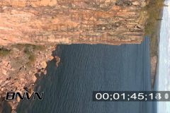

B-Roll footage from Palisade Head along the North Shore of Lake Superior. The video was shot at a 90 degree angle for use with vertical advertising and promo video displays.
Catalog #: P2_Palisade_Head02_HD
Screen Format: 16:9
Video Format: High Definition
License Type: Rights Managed
To license this footage, contact http://www.StormChasingVideo.com
B-Roll footage from Palisade Head that overlooks Lake Superior. Great scenic shot of the cliff face and water and shoreline.
Catalog #: P2_Palisade_Head01_HD
Screen Format: 16:9
Video Format: High Definition
License Type: Rights Managed
To license this footage, contact http://www.StormChasingVideo.com
B-Roll footage from Gooseberry Falls State Park along the north shore of Lake Superior. Video of the upper and lower falls with fall colors in the trees.
Catalog #: P2_Gooseberry_Falls_2008
Screen Format: 16:9
Video Format: High Definition
License Type: Rights Managed
To license this footage, contact http://www.StormChasingVideo.com
B-Roll footage from Duluth, MN at Canal Park of the Aerial Lift Bridge going up and the US Coast Guard Cutter Alder sailing under the lift bridge.
Catalog #: P2_Duluth_Canal_Park_HD_Oct08
Screen Format: 16:9
Video Format: High Definition
License Type: Rights Managed
To license this footage, contact http://www.StormChasingVideo.com

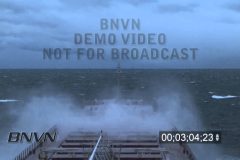
B-Roll footage of the Great Lakes freighter MV Joseph L. Block in rough sea’s with water spraying up over the bow. Also footage of the Lansing Shoal on Lake Michigan being hit with large waves and high winds that was shot from the boat.
Additional footage of lightning off the bow of the freighter while underway.
B-Roll footage of the MV Joseph L Block departing Chicago, IL and sailing back out to open water after navigating the waterway.
The first part of this video is selected clips of the departure as the Joseph L. Block sails under raised bridges and other hazards to reach open water.
The second half of the video is a 1500% of normal speed time lapse of the whole 1;02;34;23 of the master tape of this trip.
The whole master tape is available upon request for stock footage.
Catalog#: JL_Block_Depart_S_Chicago_ET
Total Run Time: 6;16;12
Format: HD
8/9/2010 Sunset to dusk crawler lightning at Siesta Key Beach, Sarasota, FL.
Catalog: 20100809a_SSM
TRT: 2;40;00
Format: HD
License Type: Rights Managed
To license this footage, contact http://www.StormChasingVideo.com
7/31/2010 Stock footage of a Spiny Lobster close up off the coast of West Palm Beach, FL
Catalog ID: 20100731c SSM HD LobsterClose
Total Run Time: 00:58
To license this footage, visit http://www.StormChasingVideo.com
7/16/2010 Stock footage of dying and diseased brain coral on A1 Reef in the Dry Tortugas Ecological Reserve.
Catalog ID: 20100716a SSM HD BrainCoralDying
Total Run Time: 00:42
To license this footage, visit http://www.StormChasingVideo.com
5/22/2010 Long low-angle shots looking up at the surface from underwater in the Gulf of Mexico. Shot in the Dry Tortugas FL area in the high sun with waves and clear blue water over the camera position.
Catalog ID: 20100522a SSM HD BlueWater
Total Run Time: 2:52
Format: HD
To license this footage, visit http://www.StormChasingVideo.com
11/30/2008 Footage of a red lifeguard warning flag blowing in the wind. Various wide and tight shots of the flag blowing on Siesta Key, FL.
Catalog ID#: 20081130d_SSM_HD
Screen Format: 16:9
Total Run Time:
Video Format: High Definition
License Type: Rights Managed
To license this footage, visit http://www.StormChasingVideo.com
8/28/2007 Along the coastline on the Gulf of Mexico in Siesta Key, Florida the setting sun illuminates towering cumulus storm clouds in vivid colors which are being side lit by the sun along with a group of condos.
Catalog ID: 20070828e SSM 16×9 Colorful Cumulus Clouds
Total Run Time: 02:05
Native: 1080i.
To license this footage, visit http://www.StormChasingVideo.com
Storms at sea and bad maritime weather stock video.
Various clips of bad weather and storm clouds at sea on the Great Lakes Freighter Edward L. Ryerson.
B-Roll footage of storm clouds, large waves, rainbows, shelf clouds and rough weather on the great lakes.
Catalog ID: Ryerson_Storms_At_Sea_ET1
Total Run Time: 08:20:18
To license this footage, visit http://www.StormChasingVideo.com
6/20/2007 The sun seen from underwater at Dry Tortugas FL.
Catalog ID: 20070620c SSM 16×9 TER Sun Underwater
Total Run Time: 00:19
Native: 1080i
To license this footage, visit http://www.StormChasingVideo.com
5/23/2008 Quinter Kansas Wedge Tornado Video. Massive wedge tornado hits just north of the town of Quinter Kansas. Footage before the tornado, south of Quinter on Castle Rock Road. Then moves into the town and ends with footage shot in high winds in the rear flank downdraft about a half mile away from the south side of the wedge tornado.
Catalog # 05232008_CC1_HD
Total Run Time: 09;16;21
Screen Format: 16:9
Video Format: High Definition
License Type: Rights Managed
To license this footage, contact http://www.StormChasingVideo.com

Sub Zero B-Roll From The Minnesota Winter Carnival Snow And Ice Sculpture At Harriet Island. Footage shot during record cold weather with temps in the -20F range and wind-chill factor of -40f and colder. Video of people out in the park at Harriet Island and checking out the ice and snow sculptures in the extreme cold weather.
Catalog ID#: STP_Winter_Carnival_2007_B
Screen Format: 4:3
Total Run Time: 08:30
Video Format: Standard Definition
License Type: Rights Managed
To license this footage for broadcast, contact http://www.StormChasingVideo.com
Various snow plow and snow clean up video. Video shot during the daylight hours of snow plows and snow clean up. Footage of snow plows being loaded with sand and salt. Snow plows clearing snow from roadways. Dash camera video of snow plows. Various footage of snow plows in action.
Catalog ID#: Snow_Clean_Up_Part02
Screen Format: 4:3
Total Run Time: 08:10
Video Format: Standard Definition
License Type: Rights Managed
To license this footage for broadcast, contact http://www.StormChasingVideo.com

5/6/2006 New Orleans, LA – Nine Months After Katrina – downtown New Orleans and Superdome video. Various general B-Roll footage around downtown New Orleans and footage of the Superdome and City Hall. Also footage of voting signs and general driving through the French Quarter video.
Catalog ID#: NOLA_9ML_11
Screen Format: 4:3
Total Run Time: 06:54
Video Format: Standard Definition
License Type: Rights Managed
To license this footage for broadcast, contact http://www.StormChasingVideo.com
Loggerhead Key Video. Very rare footage filmed on Loggerhead Key in the Dry Tortugas National Park. Video includes a tour around the island. Footage of the grave of Thomas Lehay. Video from outside the various houses and some very rare footage from inside and on top of the Loggerhead Key Lighthouse. The footage from on top of the Loggerhead Key Lighthouse show the damaged and aged condition of the old lighthouse after generations of use and from being hit by many hurricanes and tropical systems.
Catalog #: Loggerhead_Key_June_2007
Total Run Time: 17:33
Screen Format: 4:3
Video Format: Standard Definition
License Type: Rights Managed
To license this footage, contact http://www.StormChasingVideo.com
A man at an ice skate park in Minneapolis is playing with his kid. The man is wearing an orange cone on his head like a Dunce Cap as the kid tries to push him on the ice. The kid just punches the man directly in the balls and the man starts to fall over in pain until he see’s the camera and then tries to play it off.
Catalog ID#: Funny_Weather_01
Screen Format: 4:3
Total Run Time: 00:27
Video Format: Standard Definition
License Type: Rights Managed
To license this footage for broadcast, contact http://www.StormChasingVideo.com
Devils Tower, Wyoming. B-Roll of the nation’s first National Monument, Devils Tower. Video from at a distance of Devils Tower from several miles away, to right up next to the base of the tower.
Catalog ID#: Devils_Tower_WY_01
Screen Format: 4:3
Total Run Time: 04:11
Video Format: Standard Definition
License Type: Rights Managed
To license this footage for broadcast, contact http://www.StormChasingVideo.com
Aviation And Lightning Video. Airplanes and Lightning Video. Various video clips of lightning and airplanes and aviation related theme. Airplanes flying with lightning, airplanes on the ground with lightning and fuel tanks with lightning in the background.
Catalog ID#: Aviation_Lightning-B
Screen Format: 4:3
Total Run Time: 03:08
Video Format: Standard Definition
License Type: Rights Managed
To license this footage for broadcast, contact http://www.StormChasingVideo.com
Winter storms and aviation de-icing video. Footage of airplanes being deiced in the middle of winter storms. Footage of runway snow removal and snow clean up crews. Various Dates.
Catalog ID#: Aviation_Deice_Part_03
Screen Format: 4:3
Total Run Time: 06:25
Video Format: Standard Definition
License Type: Rights Managed
To license this footage for broadcast, contact http://www.StormChasingVideo.com
The video posted to our Youtube Channel is NOT sponsored and Youtube Advertising deems storm chasing and natural disaster videos as not advertiser friendly. If you would like to support us, click on the link below to visit our merchandise store.
http://www.stormchasingvideo.com/scv-merch-store/
Airport Security Footage – September 2006. Minneapolis International Airport. Footage from the Minneapolis International Airport of travelers going through the security check points. Various shots from above and close up and wide angle of people in line and going through the check points. Also various b-roll of signs and airport staff.
Catalog ID#: Airport_Security_01
Screen Format: 4:3
Total Run Time: 11:42
Video Format: Standard Definition
License Type: Rights Managed
To license this footage for broadcast, contact http://www.StormChasingVideo.com